The canals Amsterdam represent one of the most significant urban planning projects of the early modern period. Originally designed to manage water, provide transport, and create new land for the city’s growing merchant class, this network has become a global symbol of Dutch ingenuity. As you navigate through the city, the canals Amsterdam offer a unique perspective on the transition from medieval fortification to a global commercial hub. The preservation of thousands of monumental buildings along these waterways ensures that the historic character of the district remains intact. Understanding the development of the canals Amsterdam is essential for appreciating the city’s architectural heritage.
In this blog:
The 17th-Century Expansion and the “Grote Uitleg”
The development of the canals Amsterdam began in earnest during the early 17th century, a period known as the Dutch Golden Age. As the city’s population swelled due to trade and religious migration, the medieval city center could no longer accommodate its residents. In 1613, the city council initiated a massive expansion plan known as the “Grote Uitleg” (Great Expansion). This plan involved digging three main residential canals in a semi-circular shape around the old center: the Herengracht, the Keizersgracht, and the Prinsengracht. The construction of the canals Amsterdam was a logistical feat that required the removal of massive amounts of soil and the driving of thousands of wooden piles into the marshy ground.
The first phase of the expansion focused on the northern section, reaching as far as the Leidsegracht. By 1662, the second phase extended the canals Amsterdam toward the east, ending at the Amstel River. This structured layout allowed the city to control land prices and ensure that the wealthiest merchants lived on the inner canals, while craftsmen and smaller businesses were located in the Jordaan district. The layout of the canals Amsterdam was not merely aesthetic; it was a highly functional system designed to facilitate the movement of goods from the harbor directly to the warehouses situated behind the stately facades of the merchant homes.
Tip: The Museum of the Canals, which details the 17th-century construction of the waterways, is located at the monument house Herengracht 386, 1017 CJ Amsterdam.
How to get there?
Plan my journey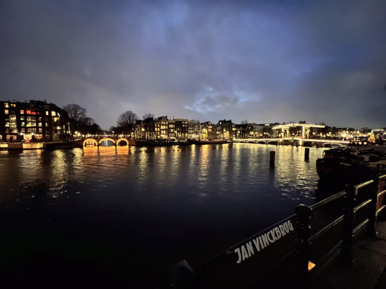


Hydraulic Engineering and Water Management Systems
The canals Amsterdam are more than just scenic waterways; they are part of a complex hydraulic system that has been refined over four centuries. Because the city is located below sea level, managing the water level is a constant necessity. Historically, the canals Amsterdam were flushed twice a week using water from the Zuiderzee to maintain sanitation. Today, this process is managed by the Regional Public Water Authority Amstel, Gooi, and Vecht. A series of locks and pumping stations ensures that the water in the canals Amsterdam remains at a consistent level of 40 centimeters below the NAP (Normal Amsterdam Peil).
The water quality in the canals Amsterdam has improved significantly in recent decades. While the canals once served as the city’s open sewer system, the installation of a comprehensive sewage network in the 1980s transformed the environment. Currently, the canals Amsterdam are home to various species of fish and birds, and the water is clean enough for regulated swimming events. Maintenance of the canal walls is an ongoing challenge, as the 17th-century foundations are subject to decay. The city of Amsterdam has allocated a multi-million euro budget for the reinforcement of several kilometers of quay walls to ensure the structural integrity of the canals Amsterdam for the future.
Tip: The official water level of the city’s waterways is regulated by the Amstel lock system, which maintains the canal depth at a target of approximately 2 – 3 meters.
UNESCO Canals Amsterdam!
Architectural Evolution of the Canal Houses
The houses lining the canals Amsterdam showcase the evolution of Dutch architectural styles from the 17th to the 19th century. Initially, the buildings featured stepped gables (trapgevels), which were popular during the Dutch Renaissance. As fashions changed, these were replaced by more classical neck gables (halsgevels) and bell gables (klokgevels). Many of the properties along the canals Amsterdam were designed as multifunctional spaces, with offices on the ground floor, living quarters above, and storage space in the attics. The narrowness of the houses is a direct result of historical taxes, which were often based on the width of the facade facing the water.
You can observe the “leaning” houses, known as “de dansende huisjes,” which are a common sight along the canals Amsterdam. This phenomenon is caused by the slow sinking of the wooden piles into the peat soil or the compression of the foundation layers over time. Additionally, many houses were intentionally built with a slight forward tilt to allow goods to be hoisted to the upper floors without damaging the windows. The interior of many homes on the canals Amsterdam features deep “keur” gardens, which were mandated by 17th-century building codes to ensure light and air circulation. These green spaces remain hidden behind the brick facades, contributing to the unique microclimate of the canal ring.
(this post will continue after this block)
Amsterdam Hidden Gems
Psss … don’t tell anyone!
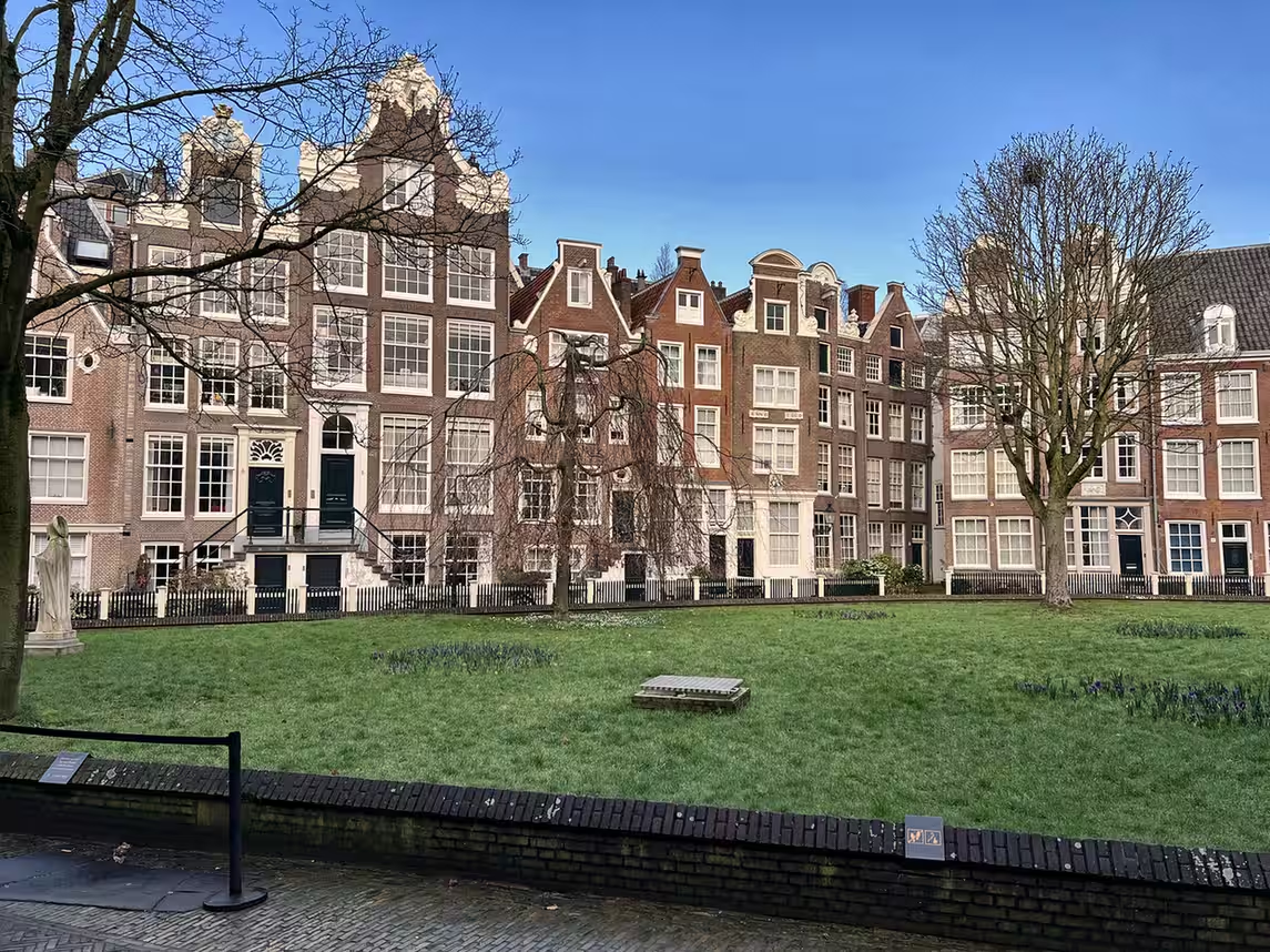
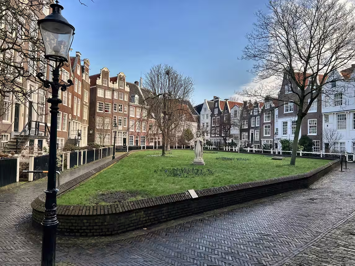
BEGIJNHOF
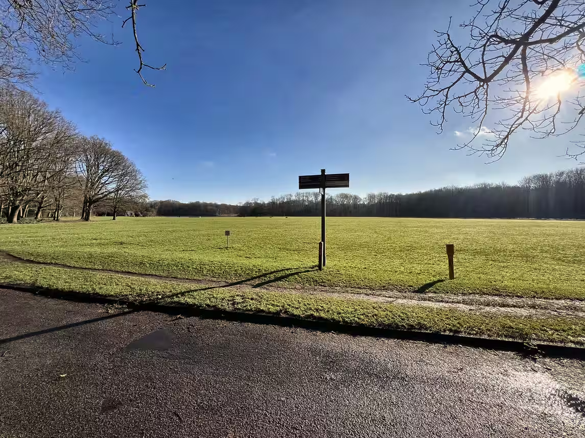
AMSTERDAMSE BOS

NDSM WARF
OOSTERPARK
UNESCO World Heritage Status and Preservation
In 2010, the 17th-century canal ring area of Amsterdam, which includes the canals Amsterdam, was officially added to the UNESCO World Heritage List. The organization recognized the site for its “outstanding universal value” as an example of a large-scale, planned urban extension. The protection afforded by this status ensures that the visual integrity of the canals Amsterdam is maintained. Any new construction or renovation within this zone is subject to strict aesthetic and historical guidelines. This means that even the color of the paint used on window frames or the type of brickwork must be approved by the city’s heritage commission.
The UNESCO designation covers an area of approximately 160 hectares, encompassing over 7,000 registered monuments. This level of preservation makes the canals Amsterdam one of the largest historic city centers in Europe. While the status brings prestige and tourism, it also presents challenges for modernization. Residents living on the canals Amsterdam must find innovative ways to make their 300-year-old homes energy-efficient without compromising the historical structure. Despite these difficulties, the commitment to preserving the canals Amsterdam ensures that the historic landscape remains a living part of the city rather than a stagnant museum.
Tip: The 17th-century canal ring was officially inscribed as a UNESCO World Heritage site during the 34th session of the World Heritage Committee on August 1, 2010.


Navigation and the Role of Commercial Transport
Historically, the canals Amsterdam were the primary veins of commerce for the city. Barges transported spices, silk, and grain from the harbor at the IJ to warehouses distributed throughout the canal ring. Today, the role of the canals Amsterdam has shifted toward leisure and public transport, but commercial activity still exists. For example, several companies use specialized electric barges to collect waste or deliver supplies to restaurants and hotels along the water. This helps reduce the number of heavy vehicles on the narrow, fragile streets that run parallel to the canals Amsterdam.
For visitors, navigating the canals Amsterdam by boat is one of the most popular activities. There are over 150 canal cruise boats operating in the city, providing guided tours that explain the history and significance of the landmarks. If you choose to rent a private boat, you must adhere to strict municipal regulations. This includes a maximum speed limit of 6 kilometers per hour on most of the canals Amsterdam. Additionally, as of 2025, the city has implemented a requirement for all commercial boats and many private vessels to be emission-free, further contributing to the preservation of the environmental quality of the canals Amsterdam.

Walking along the Canals Amsterdam made simple
The canals Amsterdam form a 17th-century hydraulic engineering masterpiece and a UNESCO World Heritage site. This network of waterways, featuring the Herengracht, Keizersgracht, and Prinsengracht, defined the city’s Golden Age expansion and remains the central structural and cultural element of the historic Dutch capital today.
Notable Residents and Historical Events Along the Water
The canals Amsterdam have been home to some of the most influential figures in Dutch and world history. The philosopher René Descartes lived on the Westermarkt, overlooking the Prinsengracht, during his time in the city. The Frank family lived in the Secret Annex at Prinsengracht 263, where Anne Frank wrote her famous diary while listening to the bells of the Westerkerk echoing over the canals Amsterdam. These historical connections draw millions of people to the area, seeking to see the physical spaces where these events unfolded. The archives of the city provide detailed records of who lived in which house, allowing for a deep exploration of the social history of the canal ring.
Beyond individual residents, the canals Amsterdam have served as the stage for major national events. The annual King’s Day celebrations see thousands of orange-clad participants on boats filling the waterways. Similarly, the Amsterdam Canal Parade, part of the city’s Pride festival, uses the canals Amsterdam as a unique floating runway for decorated barges. These events demonstrate how the 17th-century infrastructure continues to be integrated into contemporary Dutch culture. The ability of the canals Amsterdam to adapt from a site of 17th-century trade to a 21st-century festival ground is a testament to the enduring flexibility of the original urban design.
Take a virtual tour with Google Streetview!
Frequently Asked Questions (FAQ)
How many canals are in Amsterdam?
There are more than 165 canals Amsterdam, covering a total length of approximately 100 kilometers. The three main residential canals—Herengracht, Keizersgracht, and Prinsengracht—form the core of the historic canal ring.
Is it safe to swim in the canals Amsterdam?
While the water quality has improved significantly, the city generally discourages swimming in the canals Amsterdam due to boat traffic and submerged objects like bicycles. However, the annual Amsterdam City Swim is a regulated event where participants swim a specific route for charity.
Why are the houses on the canals Amsterdam so narrow?
Historically, taxes in Amsterdam were often based on the width of the house’s facade. To minimize their tax burden, residents built tall, narrow houses that extend far back into the block, often including hidden inner gardens.
Can I rent a boat to drive on the canals Amsterdam?
Yes, there are several companies that offer small electric boat rentals. You do not need a boat license for vessels under 15 meters that travel slower than 20 km/h, but you must follow the 6 km/h speed limit on the canals Amsterdam.
What is the “Seven Bridges” view?
This is a famous spot where the Reguliersgracht crosses the Herengracht. If you position your boat or stand at the intersection, you can see seven arched stone bridges lined up in a row across the canals Amsterdam.
Modern Regulations for Visitors and Residents
Maintaining the balance between a thriving residential area and a global tourist destination is a primary concern for the local government. The canals Amsterdam are subject to specific “leefbaarheid” (livability) rules designed to minimize the impact of mass tourism on local inhabitants. This includes restrictions on the number of new hotels allowed in the canal belt and regulations regarding noise levels after 11:00 PM. Visitors to the canals Amsterdam are encouraged to be mindful of the fact that the monumental houses are private residences, not merely decorative facades.
In recent years, the city has also introduced measures to manage the number of boats on the canals Amsterdam during peak periods. A vignette system for private boats and a limit on the number of commercial licenses help prevent congestion on the water. Residents of the canals Amsterdam often participate in local “wijkoverleg” (neighborhood consultations) to discuss issues such as waste management and bike parking. These collaborative efforts ensure that the canals Amsterdam remain a functional and pleasant place to live while continuing to welcome visitors from around the world. Following these local guidelines is essential for any visitor who wishes to experience the city in a respectful and sustainable manner.
Sources
- City of Amsterdam. (2026). Water Management and Canal Maintenance Records.
- Museum of the Canals (Grachtenmuseum). (2026). The History of the 17th-Century Canal Ring.
- UNESCO World Heritage Centre. (2026). Seventeenth-Century Canal Ring Area of Amsterdam inside the Singelgracht.
- Regional Public Water Authority Amstel, Gooi and Vecht. (2026). Water Quality and Levels in Amsterdam.
- Wikipedia contributors. (2026, February 10). Canals of Amsterdam. In Wikipedia, The Free Encyclopedia.
Leave a Reply